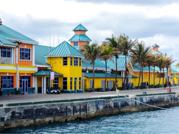
New Providence offers convenient access to Nassau, Paradise Island, local beaches, eateries, and scenic coastal roads. Renting a car in the Bahamas gives you the freedom to explore at your own pace, moving easily between popular beaches and quieter areas without relying on fixed transport schedules.
Whether you’re planning a relaxed drive along the coast or a full day of island exploration, driving in New Providence lets you experience the island on your own terms. This guide provides practical advice on the best routes, beach drives, parking, airport access, and tips for navigating the island by car.
What Is on New Providence Island?
New Providence is small enough to explore comfortably, but it offers more than one resort area. Different parts of the island give you a mix of beaches, city streets, local communities, marinas, and coastal scenery. Understanding the island layout helps you plan better routes and park more easily.
Nassau, the Capital of the Bahamas
Nassau is the island’s busy capital and the centre for shopping, dining, government buildings, and cruise-port activity. Downtown Nassau includes Bay Street, Government House, the Queen’s Staircase, and the Straw Market, all packed into a compact city area. Visitors usually spend time here sightseeing, eating local food, and visiting historical landmarks.
When driving in New Providence Island, Nassau works best when you approach it like a small urban centre rather than a beach road. Streets are busy around the harbour and shopping areas, so planning your parking before arrival helps save time.
If you arrive through Lynden Pindling International Airport, you can book with Final Rentals online before your trip and collect your car directly at the airport after landing. Flexible booking options, competitive daily rates, and practical vehicle choices make it easier for you to explore beaches, resort areas, and city roads around New Providence.
Paradise Island, Resorts, and Marina Areas
Paradise Island is across Nassau Harbour and connects to New Providence through two bridges. This area includes major resorts, marinas, restaurants, shopping areas, and Cabbage Beach. You can combine beach stops, dining, and marina walks into one visit because the area is easy to reach by car.
Beaches, Local Communities, and Coastal Areas
One of the best parts of New Providence is how quickly the scenery changes from urban streets to open shoreline roads. Cable Beach, Love Beach, Saunders Beach, Jaws Beach, and Clifton Heritage all offer different experiences around the island. You will enjoy driving in New Providence Island because a single journey can include beaches, local communities, and scenic coastal views in the same afternoon.
Best Roads and Routes to Drive Around New Providence Island
Most island driving follows a few main travel corridors rather than one circular route. Visitors usually spend their time along the north-coast beach roads, downtown harbour routes, and western coastal areas. Learning these main routes makes driving in New Providence Island much easier and more enjoyable.
Drive Along West Bay to Cable Beach, Caves Beach, and Love Beach
West Bay Street is one of the island’s most useful roads. It connects Arawak Cay, Cable Beach, Caves Beach, Love Beach, and several resort areas along the north coast. This route lets you easily stop at multiple places without long detours.
The road is close to hotels, restaurants, beach access points, and tourist areas, making it ideal for relaxed coastal driving. Many visitors remember this route most clearly because it combines beaches, dining, and sea views along one stretch.
Take East Bay Towards Downtown Nassau and Paradise Island Access
East Bay Street offers a different experience from the western beach corridor. Instead of resort areas, this route passes waterfront sections, Fort Montagu, Potter’s Cay, and the Paradise Island bridge approaches.
Explore Carmichael Road, South Ocean Boulevard, and the Clifton Area
Travellers who want to see quieter areas often head towards Carmichael Road, South Ocean Boulevard, Clifton Heritage National Park, and the wider western district. These areas are less focused on resorts and more connected to local communities, open scenery, and nature spots.
Clifton Heritage National Park includes wetlands, trails, dunes, cliffs, reefs, and quiet beach areas that offer a different side of New Providence. While driving in New Providence Island, western routes are useful if you want more space and fewer busy resort surroundings.
What to Know Before Exploring New Providence Island by Car
New Providence may look small on a map, but travel time depends more on parking, junctions, bridge traffic, and resort entrances than on long-distance driving. Understanding the road setup before you begin helps reduce stress and makes your travel days smoother.
Driving From Lynden Pindling International Airport to Nassau and Nearby Areas
Lynden Pindling International Airport is the main arrival point for visitors entering New Providence. From the airport, you can continue towards Cable Beach, downtown Nassau, Paradise Island, or the western side of the island.
The western areas usually feel more open, while roads become busier as you continue east towards Nassau Harbour. If your accommodation is near Cable Beach, the drive is often shorter and easier than continuing into downtown Nassau or across the Paradise Island bridges.
Parking, Traffic, and Fuel Stops Around New Providence Island
Parking is one of the most important things to plan ahead for when visiting Nassau and Paradise Island. Downtown areas near the harbour can become crowded, especially near shopping streets, cruise-port areas, and resort entrances. Looking for parking before arriving at busy areas usually saves time and avoids unnecessary driving around the city centre.
Traffic conditions also vary by location. Beach routes and western roads often feel calmer, while downtown Nassau and the bridge approaches require more patience due to higher traffic. Fuel planning is straightforward, but keep your tank filled before spending long afternoons around western beach areas or quieter coastal districts.
Car Rental Tips for Visiting New Providence Island
Visitors who want to rent a car in the Bahamas usually pick up their vehicles from the airport upon arrival. Choosing a comfortable car size helps make hotel parking, beach stops, and city driving easier. If this is your first time driving on the left, keeping your first day simple helps build confidence before longer trips around the island.
Takeaway
New Providence is easier to enjoy once you understand how its beach roads, harbour routes, bridge access, and western coastal areas connect together. Some days will feel busy around Nassau and Paradise Island, while others will be slow and relaxed once you reach the quieter beaches and coastal roads.
Rent a car in the Bahamas with Final Rentals so you can move easily between beach stops, coastal routes, and city areas with unlimited mileage, wide vehicle options, and convenient airport pickup after you land in Nassau. Book and manage your car rental at any time. Download the Final Rentals app on Google Play and the App Store.
Frequently Asked Questions
Is driving in New Providence Island easy for visitors?
Yes. New Providence is compact, and the main visitor areas are connected by practical roads that link the airport, Cable Beach, downtown Nassau, and Paradise Island. The biggest adjustment is driving on the left and staying alert at junctions, bridge approaches, and busy resort zones.
Should you rent a car in the Bahamas to explore New Providence Island?
If you want flexibility, yes. Car hire is available at the airport, and a car makes it easier to move between beaches, downtown Nassau, western coastal areas, and Paradise Island without depending on taxis.
What side of the road do you drive on in New Providence Island?
You drive on the left side of the road. Bahamian driving rules also require seat belts and careful driving at junctions and in pedestrian areas.