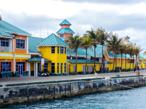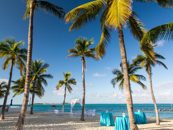
West Bay Street in Nassau is one of the easiest routes for seeing the northern coast of New Providence. It links central Nassau with beaches, resorts, local communities, and western residential areas. The road also runs west through the main Cable Beach corridor.
If you are renting a car, the route gives you a simple way to explore the coast. As you head west, you pass public beaches, hotel areas, limestone caves, and quieter western shores. Among the scenic drives in Nassau, you get a useful mix of coast, culture, and local life. Our guide covers the route, main stops, driving times, traffic, parking, and public beach access.
West Bay Street gives you a clear view of how Nassau changes as you travel west. The route moves through busy city areas, beaches, resorts, local communities, and quieter residential districts. The things to do on West Bay Street in Nassau are also surprisingly varied for one road. You can swim, eat Bahamian food, explore historic places, snorkel, or watch the coastline change.
A practical westbound trip begins near Downtown Nassau and Western Esplanade. From there, West Bay Street follows much of the northern side of New Providence towards Cable Beach and western districts.
The route can be useful for first-time visitors because you can keep your drive straightforward. You can head out of central Nassau without relying on a series of smaller local roads. Along the way, you pass Junkanoo Beach, Arawak Cay, Saunders Beach, Goodman's Bay, and Cable Beach. You see a different side of western Nassau at each stop.
Several beaches line the route, but each one offers a different type of beach stop. Junkanoo Beach is close to Downtown Nassau and has colourful beach shacks. Saunders Beach is popular with local families and has useful public facilities.
Goodman's Bay combines public beach access with a park, while Cable Beach stretches for about 4 kilometres. Large resorts line parts of the wider Cable Beach shoreline, so access points differ by section.
Farther west, Caves Beach has a smaller and less developed setting. Orange Hill Beach has a quieter roadside beach setting opposite the Orange Hill area. At Love Beach, you reach protected coral nearby and good snorkelling opportunities.
The surroundings change as you drive west. Downtown Nassau has more visitor and road activity, with shops, transport links, and cruise traffic. At Arawak Cay, you can stop for local food beside the route.
Cable Beach has large hotels and resort facilities. Sandyport has marinas, canals, restaurants, shops, and residential areas beside the water. Farther west, development is more spread out and mainly residential. Delaporte is part of the transition towards western Nassau. The route then continues through Caves, Orange Hill, Love Beach, Gambier, and private western residential communities.
West Bay Street, Nassau is easiest to explore when you follow the coast in geographic order. The stops below run west from central Nassau, which gives you a simple sightseeing sequence.
Start near Downtown Nassau, then follow the waterfront towards Western Esplanade. Junkanoo Beach is the first major beach stop on the route. You can reach it easily from central Nassau and the nearby Straw Market. Junkanoo Beach is also linked with the Western Esplanade waterfront. From here, the road continues towards Arawak Cay. You can expect more pedestrians and local traffic around this urban section.
Arawak Cay, widely known as the Fish Fry, is one of the route's main Bahamian food stops. The area was created with material from Nassau Harbour dredging in 1969. Its restaurants serve conch, fried fish, and other Bahamian dishes.
Fort Charlotte is just inland, opposite Arawak Cay. The fort dates from 1788 and is roughly 1.6 kilometres west of Downtown Nassau. Its hilltop position overlooks Nassau Harbour and the surrounding city. You can also detour towards Nassau Botanical Gardens and Ardastra Gardens. The botanical gardens cover 18 acres and feature hundreds of tropical plant species. Ardastra is well known for flamingos and other wildlife.
Saunders Beach is a practical stop because the sand is directly beside the road. The public beach has parking and useful facilities, including toilets, showers, shaded areas, and a children's playground. Residents often visit during weekends and holidays. After Saunders Beach, you start seeing more open coastal views as you continue towards Goodman's Bay.
Goodman's Bay comes before the main resort section when you travel west. The beach has a public park beside the sand, with grassy areas and family facilities. Parking is available nearby, although busy periods can make spaces harder to find.
One of the largest resort sections along the corridor is located here. Its properties occupy part of the wider Cable Beach shoreline. Cable Beach covers about 4 kilometres of northern coast, with resorts and several access areas.
Do not assume you can enter every hotel area from the beach. Pools, loungers, decks, and other resort spaces can have separate access rules for visitors. Goodman's Bay is one of the clearest public options nearby.

Sandyport is an easy landmark to recognise west of Cable Beach. Its development includes a marina, canals, restaurants, shops, and homes around the waterways. Sandyport Marina Village is immediately off West Bay Street. You see smaller commercial spaces mixed with marina and residential development here.

Caves Beach is one of the route's most unusual coastal stops. The beach runs beside West Bay Street, while limestone caves are across the road. Small parking areas are available around the beach and caves.
Cross carefully because normal traffic continues along West Bay Street. Facilities are more limited around Caves Beach than at Saunders Beach or Goodman's Bay. Blake Road is nearby and connects this area with roads towards the airport. Caves Village is also around the West Bay Street and Blake Road junction. You can use the area as a useful western Nassau reference point.
Continue west, and you reach Orange Hill Beach. The beach is on the northern side of West Bay Street, opposite the Orange Hill area. Parking is less formal than at Saunders Beach. You may find roadside spaces or small pull-offs, so only stop where parking is safe. Facilities can also be limited, making this a simple coastal beach stop rather than a managed park.
Love Beach is one of the main destinations along western West Bay Street. It is about 20 minutes from Downtown Nassau when traffic is light. Around 40 acres of protected coral are also near the beach.
The nearby reef makes snorkelling a popular reason to stop. Swimming and snorkelling conditions still depend on weather, waves, and your ability. Public access is available, but facilities and parking are limited compared with Saunders Beach. The surrounding area is more residential than Cable Beach.
West Bay Street continues beyond the main Love Beach area towards Gambier Village. Gambier is one of New Providence's oldest historic village communities, with roots in the early 1800s.
The village was established by liberated Africans, giving it a different role from the beach stops nearby. Historic places include St Peter's Native Baptist Church and the community well. Traditional rock-oven heritage also forms part of Gambier's local cultural history. Village tours may require arrangements before you arrive. Gambier is more of a cultural stop rather than another beach stop.
Farther west, you reach the Old Fort Bay and Lyford Cay area. Both names are useful landmarks for western New Providence, but they are private residential communities.
Old Fort Bay has controlled access and private residential land. Lyford Cay is at New Providence's western end, about 21 kilometres from Downtown Nassau. It is an established private residential community with gated access. Do not enter gated residential roads without permission. Stay on public roads and use recognised public access points during your drive.
Good planning depends on distance, traffic, parking, access, and direction. Driving around West Bay Street in Nassau is fairly simple for visitors. Several stops can still turn the route into a longer outing.
Distances depend on your starting point in Downtown Nassau. Cable Beach is around 7 to 10 kilometres away, depending on the exact point you use. Love Beach is about 14 to 15 kilometres by road from central locations.
Lyford Cay is about 21 kilometres west of Downtown Nassau. A direct drive towards Love Beach can take around 15 to 20 minutes without major delays. Traffic can extend the journey during busier periods.
If you want unlimited mileage for your beach stops, book a car rental with Final Rentals before your trip. Your booking includes unlimited mileage and Third Party Liability, while Collision Damage Waiver is optional at the rental desk. You can choose an available car type based on your group, luggage, and beach gear.
You can also explore the route from western Nassau instead of starting downtown. Lynden Pindling International Airport is inland from the western coast. Blake Road links the West Bay Street area with roads towards the airport.
One option is to reach the western coast first and begin near Love Beach. You can then travel east through Orange Hill, Caves Beach, Cable Beach, Goodman's Bay, and central Nassau. You can follow the same main stops in reverse. Travellers staying near Nassau Airport may find this direction more practical.
Drivers use the left side of the road in the Bahamas. Visitors from right-driving countries should pay close attention at turns, junctions, and roundabouts.
Traffic is usually heavier around Downtown Nassau and the main Cable Beach corridor. Western stretches often have less city traffic. Watch for pedestrians, buses, side-road traffic, and cars turning into businesses.
Local buses may stop frequently along their routes. Some western sections also have bends and entrances close to the carriageway. Follow posted speed signs and slow down near busy junctions, bends, and pedestrian areas.
West Bay Street in Nassau is useful as a driving route for understanding how different parts of New Providence connect. You move from central Nassau into resort areas, public beaches, residential districts, and older western communities without leaving the same corridor. The main thing to remember is that access changes as you go. Some stops have public parking and facilities, while others need more planning before you pull over.
Rent a car in Nassau with Final Rentals and turn West Bay Street into a flexible coastal drive from Downtown Nassau to the quieter west. If you’re aged 25 to 75, you won’t face a young or senior driver surcharge, and several major foreign licences are accepted without an International Driving Licence. Book and manage your car rental anytime by downloading the Final Rentals app on Google Play and the App Store.
Yes. The route connects beaches, historic sites, and local areas along one coastal road. You can stop at Arawak Cay, several public beaches, limestone caves, and western communities. You also see how Nassau changes beyond Downtown and the main resorts. Plan several stops so the journey is more than a simple trip west.
Downtown Nassau to Love Beach takes about 15 to 20 minutes with light traffic. Busy periods can make the trip longer, especially around central Nassau and Cable Beach. Sightseeing by car takes several hours because you may stop for beaches, food, parking, or historic sites. Your total time depends on how many places you choose to visit.
Popular stops include Junkanoo Beach, Arawak Cay, Saunders Beach, Goodman's Bay, Cable Beach, Caves Beach, Orange Hill, and Love Beach. You can also visit Fort Charlotte, Gambier Village, or nearby gardens for more history and local culture.